
The fastest route to the end result
Many local authorities have already discovered the numerous advantages of using VU.CITY as part of their application process.
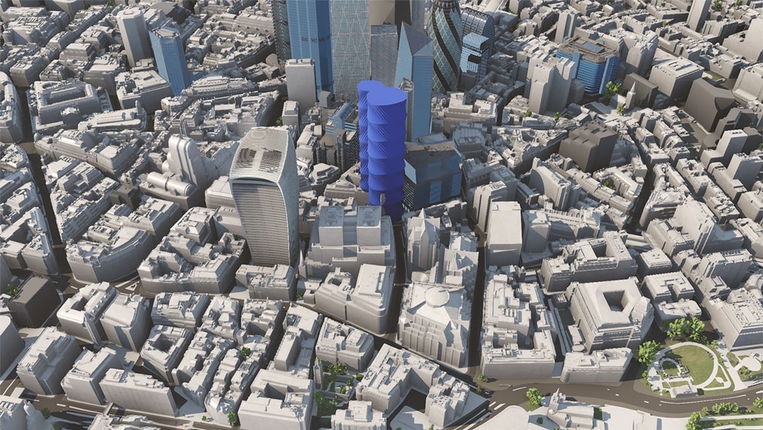
It allows you to import 3D massing models to assess proposed schemes in the context of the built environment, simply by using the interactive tools and view cameras. It also lets developers have informed conversations with planners about a site’s potential massing, scale and height.
VU.CITY helps drastically reduce costs in design iterations and creating wireframe verified views because you can scope out exactly what’s needed at an early stage.
It’s a win-win for everyone.
Optimising your models for import
Optimise models yourself by following these instructions, and using our software add-ins for Revit and Blender.
Our support team can analyse a model for you and help with any changes - simply raise a support case.
Once you’re happy with your model, you can share it securely and directly with your planning officer via VU.CITY Drive.
Over 20 UK & International Cities
Over 3,000+ sq km accurate to 15cm I Tools to scope, create & collaborate on designs


In your words

"Salford has a busy planning team, which manages a high number of large-scale developments. It is essential that the best form of development is secured on the right sites in the city, and to help with that we have been using VU.CITY. Being able to work with digital models within the VU.CITY platform has enabled the team to assess their impact more quickly from viewpoints of our choice."
Martin Hodgson
Associate Director Planning and Building Control - Salford City Council
"VU.CITY software allows for students' creativity to be displayed to full effect. The user-friendly tool enables students to demonstrate urban design & planning in a new interactive experience, bringing their proposals to life in real-time in multiple expansive urban environments."
Jack Madden
BSc Spatial Planning and Environmental Management / Urban Planning - Technological University Dublin
"VU.CITY provided a valuable resource on our work for Southwark Charities for an emerging scheme along Blackfriars Road in central London where, working with Fathom Architects, we were able to test different versions in context, have live discussions, and conclude the best approach."
Rosa Gonzalez
Consultant, Landscape, Townscape & VIA - Turley
"VU.CITY is helping us analyse projects at an early stage and refine elements of our live projects faster and more accurately. Being able to quickly assess a site or stress test things like massing and planning context provides us with more clarity and objectivity that would previously have taken us a lot longer to achieve."
Jack Hawkins
Development Manager - Londonewcastle
"VU.CITY allows us to quickly understand the feasibility of a site, in context and get rapid feedback from our project stakeholders. It helps us reduce time wasted waiting on feedback from key decision makers, by enabling real-time collaboration across a number of teams."
Nick Hayden Hub
Nick Hayden - Senior Design Manager, Mount Anvil

Our Users

.png)