No more having to work out which views are critical to assess. Run your own Zone of Theoretical Visibility (ZTV) study to see the visual impact of your scheme – all in a matter of seconds.
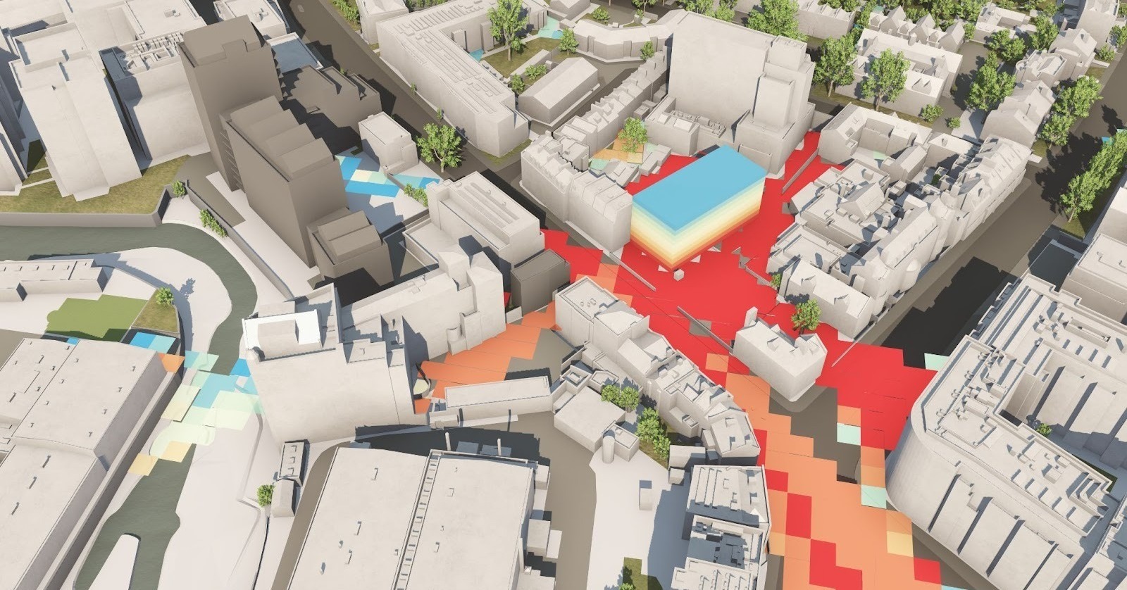
Zone of Theoretical Visibility (ZTV), also known as a Zone of Visual Influence (ZVI) or Viewshed, is an advanced scoping tool in VU.CITY that shows the effects of a proposed development by letting you instantly see where people can view it from.
Scope out your scheme’s impact
Use ZTV in the early stages of your development to determine the visual impact of a building, change its height or form, and see the difference made on the surrounding area.
ZTV studies reflect ten different height bands, colour-coded to identify exactly how much of the building you can see from any given location. Create studies with a distance of up to 2,000 m² in or, if you’d prefer wider detail or greater accuracy please get in touch.
We can also help scope verified views by running ZTVs to a borough-wide scale, with and without trees. Varying definitions of colour to show different aspects of a scheme’s height can also be customised.
ZTV at everyone’s fingertips
ZTVs are usually difficult and expensive to create but ours are available to help everyone involved in design and planning. Our ZTV tool can be used across all VU.CITY's 20+ UK and international cities, which is over 3,000 sq km and growing fast.
- Townscape consultants: scope views for consideration
- Architects: understand massing options, particularly with height analysis, for a greater sense of design feasibility
- Planning officers: discuss and agree the views required for planning
- Developers: justify schemes while remaining sensitive to the location. Use our ZTV tool with our 'Consented Scheme Timeline' tool for any areas with many consented schemes.
Want to know more?
If you’d like to find out more or commission a more accurate ZTV over a wider geography, get in touch at info@vu.city.
"ZTVs are a welcome addition to the VU.CITY platform. It’s a useful planning tool that will help us when it comes to scoping views that need consideration to ensure proposals take account of the historic environment."
Alasdair Young - Inspector of Historic Buildings and Areas, Historic England
"Another game changing tool from VU.CITY! To conduct our own ZTVs to scope views in minutes is incredibly exciting!"
Adeleh Haghgoo - Senior Consultant, Heritage and Townscape, Savills

-1-1-1.png)