
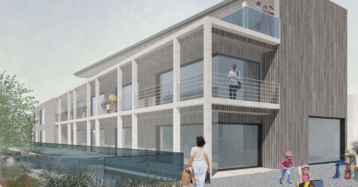
Empower Your Designs with 3D Software for Architects
Unlock the potential of VU.CITY’s digital twin technology and join the ranks of thousands of architects. Whether you're designing one particular building or an expansive masterplan, our advanced 3D modelling software empowers you to visualise, refine, and perfect every detail.

Trusted by 6,000+ users across 26 cities
Architects, developers, local authorities, urban planners, and more trust VU.CITY to help achieve their goals.
Organise and visualise your geospatial data in accurate context with our comprehensive suite of digital design and development tools.
HOW CAN VU.CITY HELP YOU?
More Work
Show constraints and opportunities in impressive detail. Test ideas in context, share them instantly with stakeholders, and deliver interactive submissions that wow and win.
Information
Understand your site from every angle. Design solutions that exceed client expectations while respecting historic and social context. Upload files and 3D models for your team to access and progress work faster.
Communications
Turn your design narrative into clear, visual 3D outputs anyone can understand. Share with all stakeholders, capture comments in one place, and enable faster, more informed feedback.
Stand Out
Produce 3D site analyses and massing visuals for masterplan options. Show the neighbourhood and city at scale, and share all documentation in a single collaboration space.
Conversations
Present designs, drivers, and documentation in a neutral, shared platform. Gain early buy-in from planners, clients, politicians and other stakeholders.
Relationships
Work more closely with clients, teams, and planning authorities. Build trust by making insights easy to understand and explain, helping decision-makers and the public see the value in your design.

TOP TOOLS FOR ARCHITECTS
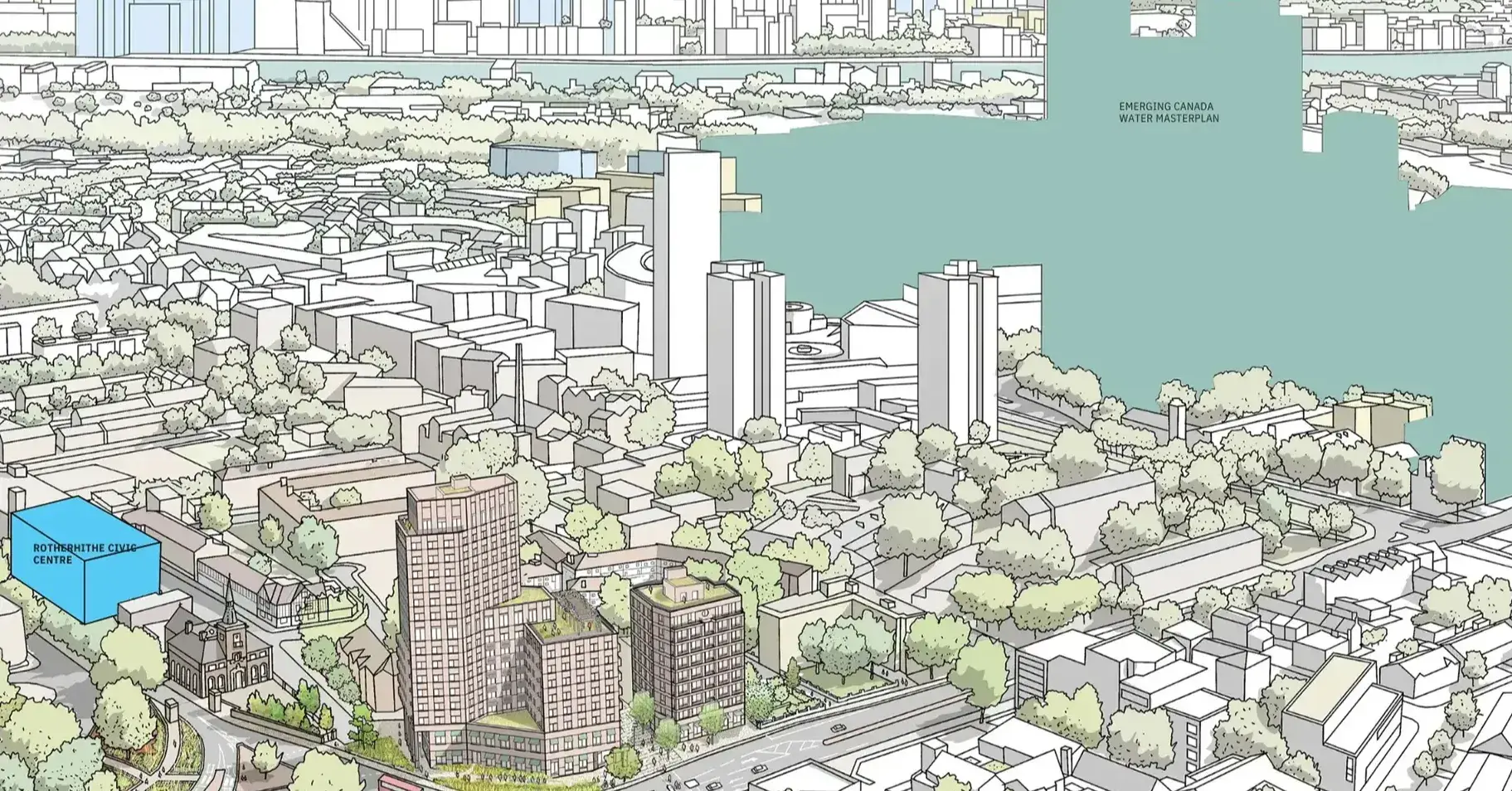
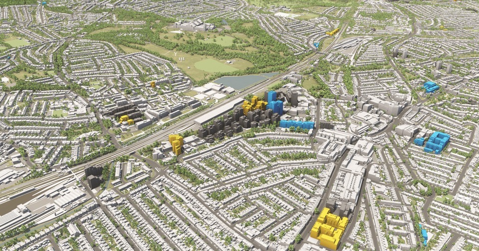
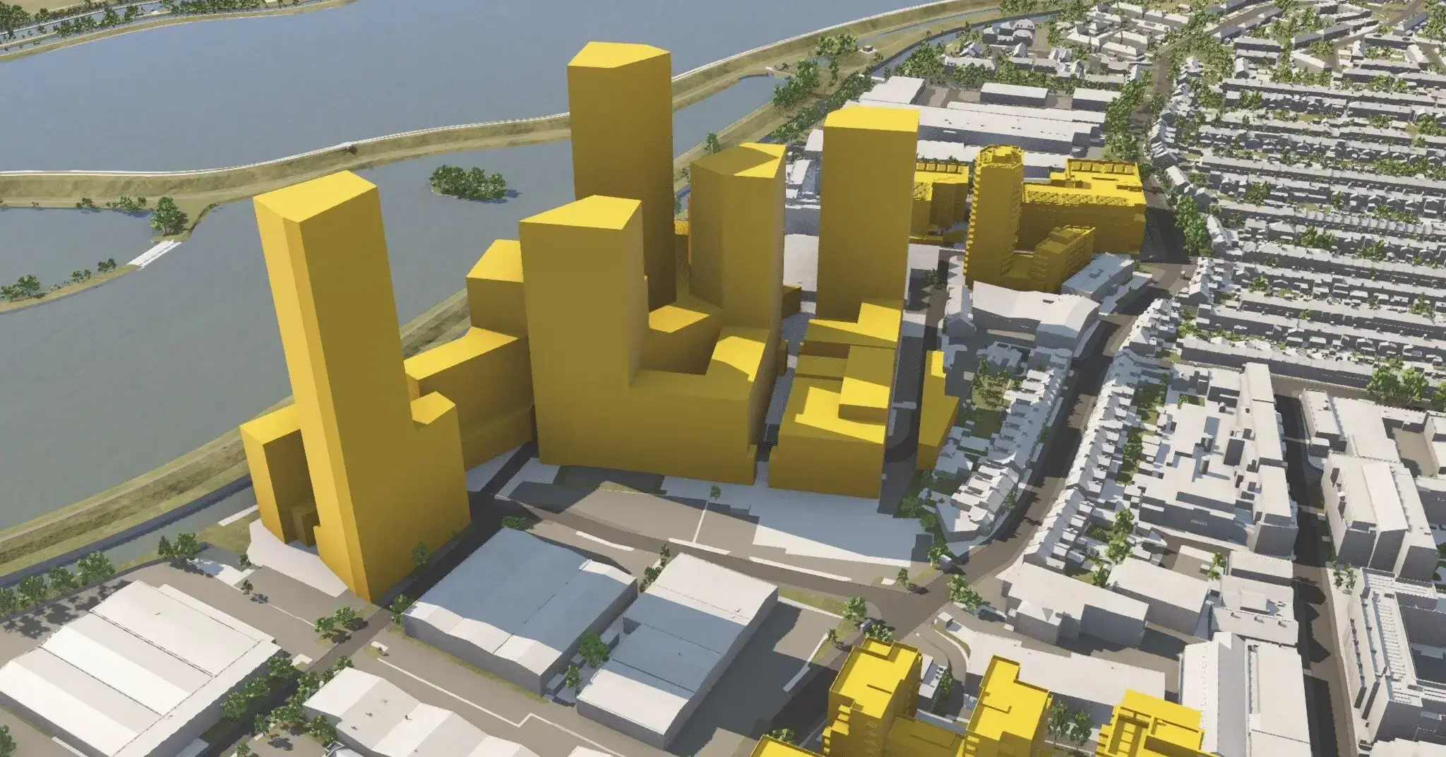
Create massing in context
Quickly assess multiple initial massing options for the right design decisions for the public realm.
Import, export and share
Achieve early buy-in by helping clients, project teams and planning authorities be crystal clear about your scheme. Viewing designs together, sharing feedback, and making revisions is a breeze.
Understand site opportunities and constraints
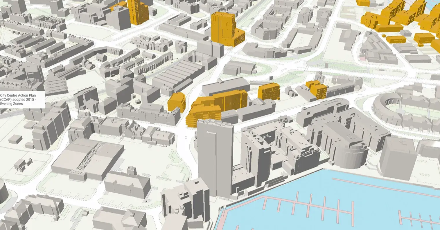
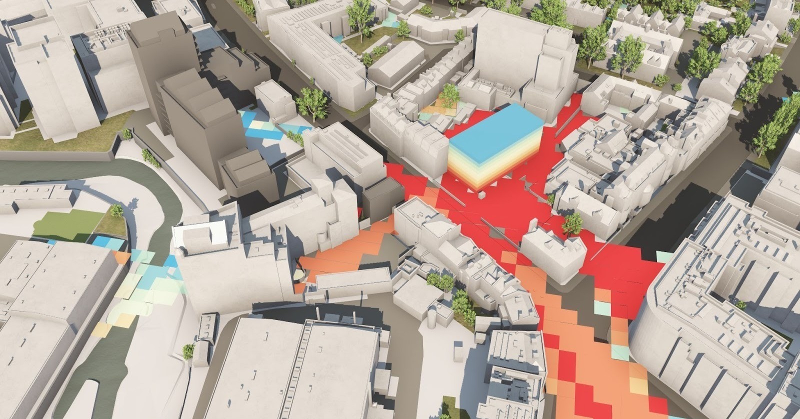
Get the full picture with data including daylight analysis, listed buildings, conservation areas, and protected views. (Data varies across our VU.CITIES to help with major early planning analysis factors.)
Camera tools and studies
Place a camera anywhere to see your scheme in context or how the view from any room would look.
Accurate measurement tools
Assess a scheme's suitability to its surroundings with AOD height tools and point measurements in a 15cm accurate digital twin.
Consented schemes timeline
Design with the current context and the future cityscape in mind. Check out major consented schemes within their setting and view key information including the developer and architect.
Scope, design and collaborate with VU.CITY
Everyone has the power to collaborate on the 3D outputs of VU.CITY. Seamlessly communicate with stakeholders, project teams and planning decision makers instantly to make better design & planning decisions, faster.
Case Studies
Discover how our forward-thinking users are making design and planning decisions the smart way -by using VU.CITY to successfully test, explain and achieve their ideas, and efficiently involve stakeholders in decision-making.
-1-1-1.png)
What is VU.CITY's 3D software for architects?
Our 3D software for architects is a comprehensive design platform that allows you to create, visualise, and iterate your projects within a digital twin environment. It combines advanced 3D modeling tools with real-time data integration to deliver an immersive, interactive design experience.
How does VU.CITY's digital twin technology enhance architectural design
Our digital twin technology replicates your project in a dynamic virtual environment. This enables you to explore multiple design scenarios, validate structural performance, and optimise details before construction begins. The result is a more efficient workflow and greater design accuracy.
What makes VU.CITY one of the most popular 3D modelling software for architects?
VU.CITY stands out with its user-friendly interface, robust modeling capabilities, and seamless integration with other design tools. Architects appreciate the platform’s ability to provide real-time feedback, facilitate collaborative design, and streamline the entire creative process.
How does VU.CITY support collaboration in architectural projects?
Designed with teamwork in mind, our platform allows multiple users to work on a project simultaneously. Whether you're sharing models with colleagues or consulting with stakeholders, VU.CITY’s collaborative features ensure everyone stays connected, reviews designs in real time, and contributes effectively.
Can VU.CITY integrate with my existing design tools?
Yes, VU.CITY's 3D software is built to complement your current workflow. It offers seamless integration with popular BIM and design tools, enabling you to import and export project data effortlessly. This connectivity ensures you can enhance your designs without disrupting your established processes.
How do I get started with VU.CITY's 3D software for architects?
Getting started is simple. Contact our team to schedule a demo or consultation. We’ll walk you through the platform’s features, demonstrate how it fits into your design process, and help you integrate our tools into your projects so you can start designing smarter right away.
VU.CITY seamlessly integrates with leading 3D digital software for an easy fit into existing workflows.
We are compatible with the biggest 3D software providers so that you can focus on your designs and plans with minimal disruption.
SiteSolve is our early-stage site exploration and generative design tool. Find out more.

Optimise FBX exports from Revit with our VU.CITY Revit Plugin and Update Agent. Embed materials, maintain positioning, and more.
Export SKP models to FBX using our VU.CITY SketchUp Plugin (beta). Produce FBX files optimised for use in VU.CITY.
Optimise and fix common issues with FBX models using our VU.CITY Blender Add-in. It's the best model editor we've come across.
26 UK & International Cities
Over 3,000+ sq km accurate to 15cm | Tools to scope, create & collaborate on designs
Explore digital 3D geospatial solutions for the built environment
VU.CITY provides clear, powerful tools for key decision-makers across the built environment, helping them visualise and shape the future of cities with confidence and precision.
Make smarter decisions with data-driven insights, from infrastructure to sustainability.
Unlock the power of Generative AI for optimal design and streamlined decision-making.
Bring your designs to 3D life with state-of-the-art modelling tools.
Collaborate seamlessly across studies, planning, and design.
Utilise advanced 3D models and a data-driven approach with our flexible ZTV service.
Bring Your Vision to Life with a 3D Flythrough Video.
Shape Tomorrow’s Cities, Today.
Begin Your Free Trial Now.
